Home - Search - Browse - Alphabetic Index: 0- 1- 2- 3- 4- 5- 6- 7- 8- 9
A- B- C- D- E- F- G- H- I- J- K- L- M- N- O- P- Q- R- S- T- U- V- W- X- Y- Z
Coriolis
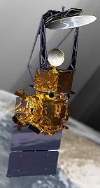
 Coriolis Credit: USAF |
Status: Operational 2003. First Launch: 2003-01-06. Last Launch: 2003-01-06. Number: 1 . Gross mass: 828 kg (1,825 lb).
Coriolis was an Air Force Space Test Program (SMC Det 12 ST) and Space and Naval Warfare Systems Command (SPAWAR) 3-year meteorological science mission to demonstrate the viability of using polarimetry to measure ocean surface wind speed and direction from space, and to demonstrate predictions of geomagnetic disturbances through continuous observation of Coronal Mass Ejections (CMEs).
The two Government furnished payload instruments were:
- WindSat, a 341 kg yaw-spinning, passive, polarimetric microwave radiometer developed by the U.S. Navy and the National Polar-orbiting Operational Environmental Satellite System (NPOESS) Integrated Program Office (IPO). WindSat was a risk reduction item in the development of the planned production Conical Microwave Imager Sounder (CMIS).
- Solar Mass Ejection Imager (SMEI), a 35 kg camera-based sensor developed by the USAF Research Laboratory (AFRL) and built by the University of Birmingham, UK, and the University of California at San Diego (UCSD). SMEI monitored solar activity through three separate cameras with a collective 3x180 degree FOV, allowing full sky coverage during each orbit. Detection of potentially damaging Earth-bound CMEs would help to protect space assets and to maintain stable communications.
These instruments gathered science data which the spacecraft stored in mass memory and subsequently downlinked at up to 51.2 Mbps to a commercial X-band ground station with end-to-end latency as low as 4 hours. Prime contractor Spectrum Astro had Total Space Vehicle Responsibility, which included spacecraft design, manufacture, integration and test; experiment integration; space vehicle verification; launch processing; and on-orbit checkout.
Coriolis Specifications
General
- Vehicle Envelope: 6.9 m high x 3.0 m diameter, deployed
- Mass: 817 kg at launch (395 kg dry bus; 82 kg propellant; 340 kg PL)
- Orbit Average Power Consumption: 725 Watts (271 W bus; 454 W PL)
- Core Bus Design: Spectrum Astro's SA-200HP, redundant
- Launch Vehicle: Titan II, 7.62 m stretched fairing
- Launch Date: January 6, 2003
- Operational Orbit: 830 km circ @ 98.7 deg , sun synchronous, twilight
- Mission Lifetime: 3 years (5 yr goal)
- Radiation Tolerance: 26 Krads total dose
- Demonstrate the polarimetric microwave radiometry technique for measuring ocean surface wind vector (NPOESS/CMIS risk reduction)
- Downlink real time data products to field users, continuously
- Demonstrate prediction of CME-based geomagnetic storms Instruments
- WindSat Polarimetric Microwave Radiometer with a highly sensitive receiver, operating at 6.8 to 37 GHz
- Radiometer antenna assembly spinning about yaw at 29.6 RPM
- Solar Mass Ejection Imager (SMEI) provided 4p sr of sky coverage
per orbit, monitors CME propagation through interstellar space
-
Structures and Mechanisms
- Al honeycomb / Al facesheet construction
- Bus module was a sealed Faraday cage to reduce radiated emissions
- Four point bolted interface for the WindSat payload
- Flexure mounted ACS optical bench, mounted on WindSat payload
- Three panel deployable array (2 hinge lines, 4 springs, 2 dampers)
- Dual-junction GaAs solar arrays; 1174 Watts at EOL
- 50 A-hr NiH2 SPV battery
- 28 ± 6V power bus, payloads, and deployments
- Automatic load shedding of payload and nonessential loads
- Flexible, flight proven, 6U VME-based architecture
- RAD6000, 20 MHz CPU with 128 Mbytes DRAM
- 1553B payload data interface, 30 Gbit solid state recorder
- 3-axis stabilized, pitch momentum biased
- Stellar-inertial attitude determination; Wheel based pointing control; Magnetic momentum management
- ADACS max. errors (3s, steady-state spin): 324 arcsec control; 194 arcsec knowledge; 108 arcsec jitter (spacecraft flexibility)
- GPS-based orbit knowledge to <100 m, 10 cm/sec, all axes
- 128 Kbps SOH telemetry downlink; 2 Kbps encrypted command uplink (SGLS)
- Selectable 25.6 or 51.2 Mbps X-band PL data downlink (CCSDS)
- SMQ-11 continuous tactical downlink at 256 Kbps (SGLS)
- Bit error rate < 10-6 (all links)
- Cold biased with radiators and MLI blankets to adjust energy balance
- Thermostatically controlled heaters
- Thermally isolated WindSat interface; coupled SMEI interface
- Monopropellant, hydrazine, blowdown system
- Four thrusters, 4.4 Newtons each
- 23 March 1999 - Spectrum Astro Selected to Provide Satellite for Coriolis Mission
- 2 August 2001 - Spectrum Astro Ships Coriolis Spacecraft to NRL
- 18 April 2002 - Coriolis Spacecraft Undergoes Environmental Testing
- 4 December 2002 - Coriolis Spacecraft Moved to Launch Pad
More at: Coriolis.
Family: Earth, Earth seasat, Technology. Country: USA. Launch Vehicles: Titan, Titan II, Titan II SLV. Launch Sites: Vandenberg, Vandenberg SLC4W. Bibliography: 2, 554, 6426, 12186.
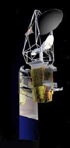
 | Coriolis Credit: Manufacturer Image |
2003 January 6 - . 14:19 GMT - . Launch Site: Vandenberg. Launch Complex: Vandenberg SLC4W. LV Family: Titan. Launch Vehicle: Titan II SLV.
- Coriolis - .
Payload: SA-200HP, P98-2. Mass: 828 kg (1,825 lb). Nation: USA.
Agency: USAF.
Manufacturer: Gilbert.
Class: Technology.
Type: Navigation technology satellite. Spacecraft Bus: SA-200.
Spacecraft: Coriolis.
USAF Sat Cat: 27640 . COSPAR: 2003-001A. Apogee: 936 km (582 mi). Perigee: 742 km (461 mi). Inclination: 98.74 deg. Period: 101.55 min.
Coriolis was an Air Force Space Test Program three-year meteorological science mission to demonstrate the viability of using polarimetry to measure ocean surface wind speed and direction from space, and to demonstrate predictions of geomagnetic disturbances through continuous observation of Coronal Mass Ejections. Launch delayed from August 22, November 15, December 15, 16, 17 and 18, 2002 and January 5, 2003.
Back to top of page
Home - Search - Browse - Alphabetic Index: 0- 1- 2- 3- 4- 5- 6- 7- 8- 9
A- B- C- D- E- F- G- H- I- J- K- L- M- N- O- P- Q- R- S- T- U- V- W- X- Y- Z
© 1997-2019 Mark Wade - Contact
© / Conditions for Use